

Border crossing
Border crossing - Explanation -
We first learn of boundaries in the local area in a document from the year 1048, where the boundary of the Haiger church district is described, and this document also mentions for the first time a Herborn and a Haiger mark.
Following this large-scale demarcation of the royal marks, the settlement of the country gradually increased, larger settlements were established, and Herborn was granted city rights in 1251.
The exact time and development of Herborn-Seelbach are unknown. Although a chapel is mentioned for our village as early as 1290, the settlements of Dernbach and Monzenbach still existed at that time. We do not know when the first boundaries were established within the area of our present-day district. Regarding the so-called "Dringelstein" (*), the rocky outcrop on which the "Jahntempel" now stands, it is said:
“…since the old folks report that when you pour a bucket of water on it, the water flows partly towards Herborn and partly towards Seelbach, so it should also be with the border. …” from: Eugen Huth; Herborn – Mark and Town, p. 67 (*)
The word "triangle" is relatively new to our language; previously, the word "triangel" was used to describe this shape. This, as is often the case with place names, refers to the shape of the mountain. So, in essence, it means a striking "pointed mountaintop".
The first written records are border crossing protocols from the 17th century. Apparently, the border was only crossed very irregularly at that time, and there seem to have been very few permanent border markers.
People used prominent terrain features, hedges, or trees for orientation. However, boundary stones, described as "hexagonal" or "Byl stones" (basalt columns), are also mentioned at significant points in the landscape. If you look closely today, you can still find these basalt columns in precisely these locations. They are therefore the oldest of our boundary stones!
After the catastrophic years of the Thirty Years' War, the population increased steadily in the following decades, and the peripheral areas of our district were used more and more intensively. In the 18th century, several border disputes with neighboring districts are documented in the archives, and the boundary was now also "more closely demarcated," meaning that additional stones, mostly natural fieldstones, were placed between the existing basalt columns.

But border violations occurred repeatedly, especially in areas of former pastures, where cattle were often driven between the boundary stones into the forests and meadows of neighboring communities. A further act of boundary demarcation followed. Where possible, a ditch was dug along the entire boundary line, parts of which are still clearly visible today. In exposed locations where the solid subsoil did not permit a ditch, fieldstones were placed in long rows along the border, which still resemble remnants of walls (e.g., on the Funkenberg and Rauer Berg). While it was possible to occasionally "overlook" a boundary stone, now everyone crossing the ditch knew they were on the territory of the neighboring community—no mistake possible!
To facilitate border control (which was not carried out regularly at that time), the boundary stones were numbered. This allowed a missing stone to be identified immediately and the gap to be filled.
Stone number 1 and the last stone, number 242, stand at the mill weir on the Aar River. The numbering proceeds counter-clockwise. The first detailed description and numbering can be found in the stone-laying register from 1827.
It was only in the 20th century that border crossings appear to have taken place in regular succession.
The municipality of Herbornseelbach maintained this old custom every year "between the years." After the incorporation in the 1970s, regulars from Seelbach kept the walk along the border alive.
It was only in 1989 that the newly founded local history and heritage association Herborn-Seelbach took over this tradition and has since been regularly commemorating about a third of the municipal boundary.
The “Historical Border Walk” is an integral part of club life and the associated cultivation of local pride.
Click on the photos to enlarge them!


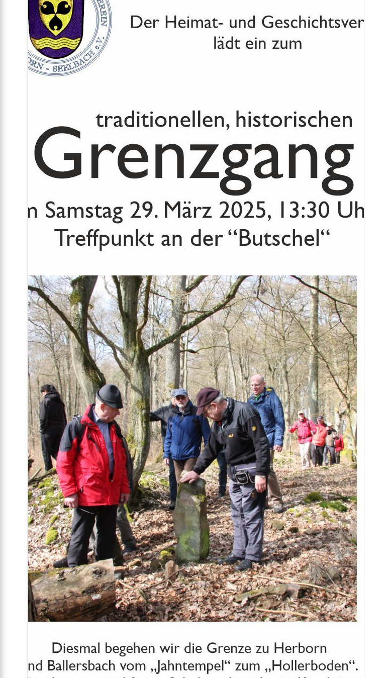
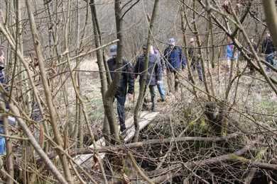
Border Crossing 2025 -
Herborn - Ballersbach; Jahntempel - Hollerboden


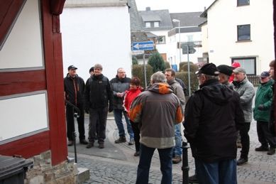
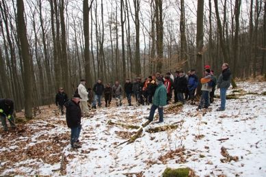
Border Crossing 2024 - Report -
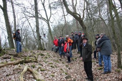
For many years, the Herbornseelbach Historical Society (HGV) has been walking the Herbornseelbach municipal boundary. Whenever possible, they visit the numbered boundary stones located directly along the border. This year, this historical boundary walk took place on March 23rd; unfortunately, the weather forecast for that day was not ideal, resulting in a lower turnout. To walk the northern and western boundaries with the districts of Oberscheld, Niederscheld, and Burg, we met at the former barracks gate and, led by Christian Görzel, set off along Hohe Straße, past the tree nursery to the "Milchertswiesenkopf," where the actual boundary walk began at boundary stone number 111. We continued along the boundary with Oberscheld, past the "Süssensrein" (the old Wickenhain mine), to boundary stone number 116, the northernmost point of our district; at stone number 117, we reached the highest point of this year's walk at 422 meters. Passing the enormous hole left by the Oberscheld quarry, we descended into the Monzenbach valley, where the border follows the stream on both sides. Boundary stone 138 marks the three-way boundary between the municipalities of Oberscheld, Niederscheld, and Herbornseelbach. At stone 170, we left the Monzenbach valley and walked along the "Kunzeboden" up to boundary stone 174, a three-way boundary between Niederscheld, Burg, and Herbornseelbach. This year's boundary walk ended on the "Gänsberg," and we enjoyed refreshments at the "Harker" inn.
Click on the photos to enlarge them!


Border walk, March 26, 2016
Route: Mine cart - tree nursery cottage - border near stone 111 - Wickenhain - Oberschelder quarry (break) - Süsserrain - Monzenbach - Herrschaftliche Wiesen - Blätterboden - Harcker and finally barbecue in the lower Monzenbach valley


Border walk, March 30, 2013
Route: Old School - Walzenmühle - Coat of Arms Stone on the Cycle Path - Hermannsgrube - Minzental - Heide (Stone 222) - Dernbachtal (Seelbacher Südpol, Stone 212) - Neue Welt - Schmittegrund - Jahntempelchen - Dernbachwiesenweg via Schmitteberg and Krummstück to the end at Hutschbeul in the Dernbachtal


Border Crossing 2011
Route: Cemetery - Hohehell - Äbbelsberg - Tree nursery cottage - Stone 111
- Falkenstein - Nesselhof - Huttenbach/Haferboden - Eisenkaute - Nesselhofer Weiher - Neue Contanze - Nesselgrund - Seibelborn - Weisse Steine - Funkenberg - Schwarz Irlen - Stein 11 - End in Schmalbach


